Unmanned aerial vehicles (UAV) for testing torrent and avalanche control measurers
Beitragsinhalt
Using UAVs are cost efficient, flexible and multifunctional ways to create geodata. The so-called drones are operating today in the fields of mechatronic, aircraft industry, navigation and software development after rapid technological developments. BFW explores within the project BAUWEKA II potentials and limitations of utilizing this new technology to study water catchment areas, protective forests and regions of risk of descending avalanches.
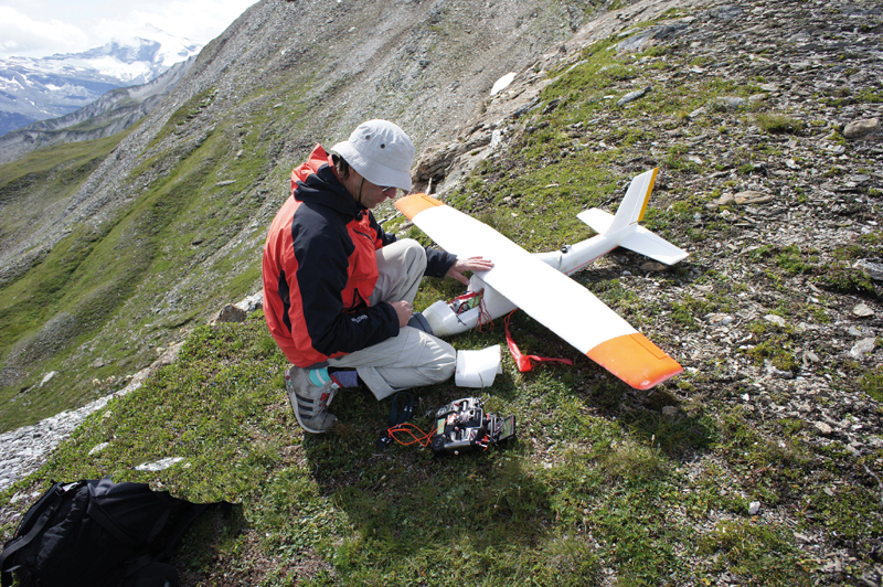
Experts from the Department of Natural Hazards carried out 14 experimental UAV flights in the Tuxer Alps (Tyrol) at an elevation of 1800 m to 2700 m above sea level. 43.000 aerial images were shot in summer 2014 during the testing period. The unmanned aerial vehicle used had a wingspread of 1.6 m and a weight of 2.5 kg and carried a modified system camera (Sony NEX-5).
Different software systems were used to process, evaluate and analyse the data. A wide range of sensors, camera angles, flight tracks, analytic tools and evaluation routines were tested.
Cost efficient monitoring
The outcomes of the experiment are orthophotos and digital terrain models with a resolution up to 2 cm. Images of near-infrared radiation of forest sites were taken to assess the vitality of protective forests. The promising outcomes show the manifold possibilities of applying this new technology in evaluating natural hazard protection.
Decision making on land use planning can be supported by this up to date high-resolution data collected with UAVs (photos, videos). It offers efficient ways to control safeguarding measurers against avalanches and torrents. The project shows that UAVs are indeed a cost-efficient way to regularly monitor protective structures.