Research group investigates the behaviour of forest fires
Beitragsinhalt
Forest fires have so far been a marginal topic in Austria, but in the future an increase in such events is expected. A group of researchers is currently investigating how the behaviour of fires in forests can be better assessed.
According to regional climate models and various studies, longer heat waves and more intensive dry periods are to be expected in Austria in the coming years. The fact that this will be accompanied by an increase in forest fire incidents has also been drastically demonstrated by the last hot summers. Despite the constant readiness of the volunteer fire brigades and a good infrastructure, problems with coordination, water supply, aviation support and the choice of fire-fighting techniques occurred again and again during fire-fighting.
Within the framework of the EMERGE project, BFW is working together with BOKU and other partners (see below) on basic principles for an improved assessment of the behaviour of forest fires in Austrian forests. In this way, the existing early warning system for forest fire risk can be expanded to include information on the spread potential and fire intensity. This is because the Canadian Fire Weather Index (FWI) used so far contains purely meteorological input parameters. However, a forest fire is also significantly influenced by the topography, vegetation type and structure of the forest.

Forest fire risk map and forest fire simulator
In recent years, BFW has developed remote sensing methods that can also be used for forest fire risk mapping. This involves the processing of aerial and satellite images from which a surface model of the vegetation can be derived. From this, a tree species mixture map is created. The tree species is important for forest fires because not all tree species burn equally well. One factor is the thickness of the bark or the amount of resin. Pines, for example, have a higher resin content and are therefore more flammable than other tree species. With the tree species mixture map, it is therefore possible to get a picture of the woody plants in a forest without ever having entered it. These data bases are very well suited for evaluations within the framework of the creation of a forest fire risk map.
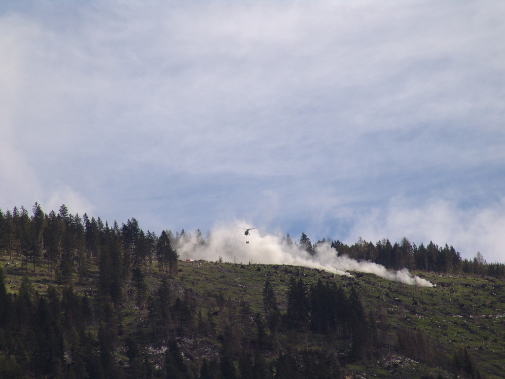
Such an instrument is ultimately a goal of the project, which is to be made accessible to the general public via the website of the Central Institute for Meteorology and Geodynamics (ZAMG). Work is also being done on a forest fire simulator. For this purpose, experiments are being carried out at the Allentsteig military training area to observe and analyse fire behaviour.
Project information
Project title: EMERGE
Project title long: Improved estimation of forest fire behaviour in Austria
Duration: 01.01.2022 – 30.09.2024
Funding Organisation: Austrian Forest Fund
Project management: BOKU – University of Natural Resources and Applied Life Sciences, Vienna
Project partners:
• BFW
• Lower Austrian Fire and Safety Centre
• Vienna University of Technology – Department of Geodesy and Geoinformation
• Federal Ministry of Defence – Military Training Area Allentsteig
Contact
Susanne Karel, Federal Forest Research Centre, Seckendorff-Gudent-Weg 8, 1131 Vienna, susanne.karel@bfw.gv.at